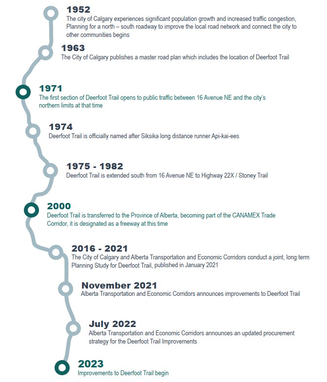
Deerfoot Trail is currently Alberta’s busiest freeway and a critical component of Calgary’s transportation network for both commuter travel and goods movement. Since the road’s initial construction in the 1970s, Calgary’s population has doubled, more people have access to vehicles, and traffic volumes have continued to increase. Improvements are needed to bring the road’s capacity closer to the current and projected traffic demands, as well as improve the safety and reliability of this important transportation corridor.
2020 Deerfoot Trail Corridor Study
The 2020 Deerfoot Trail Corridor Study was a joint initiative between Alberta Transportation and Economic Corridors and The City of Calgary to develop a plan to manage traffic and improve safety on Deerfoot Trail. This study was used to identify areas along the corridor to be prioritized for improvement.
The original alignment of Deerfoot Trail was planned to follow the Nose Creek Valley, pass through the community of Inglewood, and then continue along the Bow River Valley. Community opposition and natural and built constraints resulted in the alignment we see today.
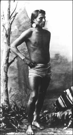
Deerfoot Trail was originally named Blackfoot Trail and was renamed in 1974 after long distance Siksika runner Api-kai-ees, pictured here in 1886.
Image credit: Glenbow Museum
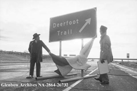
Published in the Calgary Herald, January 20, 1975. Mayor Rod Sykes and Highways Minister Clarence Copithorne unveil new Deerfoot Trail sign.
Image credit: Glenbow Museum